

How Aerial 3D Mapping Changed Cartography Forever
- Martin Holmes
- Sep 4, 2025
- 3 min read

From Ancient Mapmaking to Modern Drone Mapping
For much of history, maps were made with patience, skill, and a lot of guesswork. Cartographers used compasses, rulers, and endless measurements to draw maps that were often works of art, even if they weren’t always precise.
Today, the way we make maps looks completely different. With tools like aerial 3D mapping, we can see landscapes from above in ways those early mapmakers could only dream about.
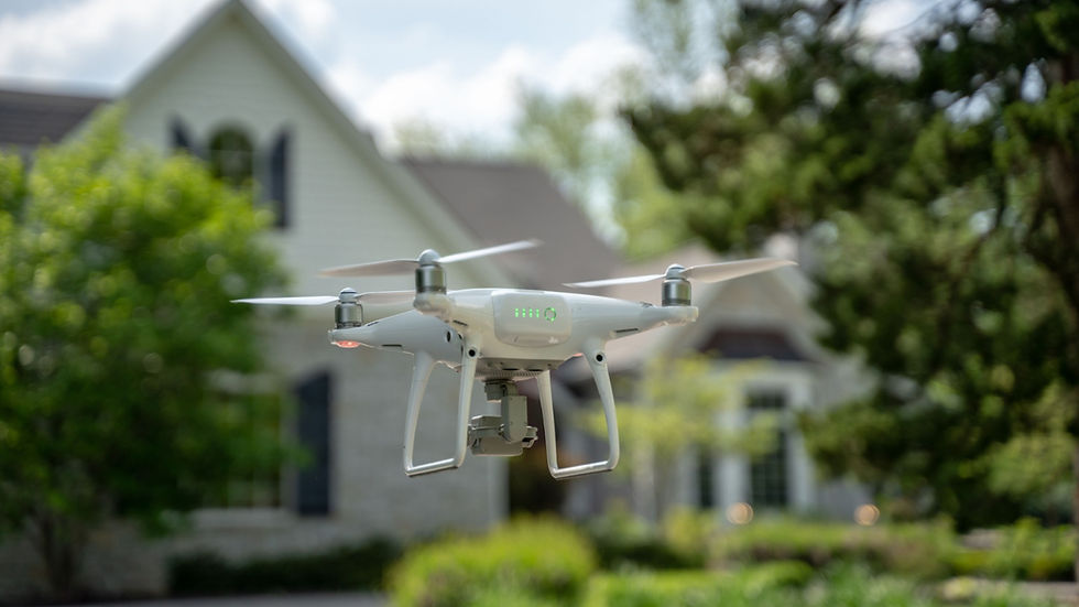
Thanks to modern drone photography and aerial map photography, what once took weeks of careful surveying can now be captured in stunning detail from the sky. It’s a big step forward, and it shows just how far cartography has come.
The Rise of Aerial Photography in Mapmaking
The introduction of aerial photography during the 20th century marked the first major leap forward in mapping. From hot air balloons to airplanes, the ability to capture images from the sky provided a perspective that ground-based surveying could never achieve. These aerial images made it possible to chart landscapes more accurately, document land changes, and support industries ranging from agriculture to military defense.
Today, aerial photography maps have evolved into sophisticated, high-resolution digital models. With the integration of drones, satellites, and advanced software, cartographers can produce not only flat maps but also immersive 3D representations of terrain.
What Makes Aerial 3D Mapping Different?
Unlike standard aerial images, aerial 3D mapping uses overlapping drone photography to create realistic, three-dimensional renderings of landscapes. Specialized software then processes this imagery into highly accurate models. This level of detail provides measurable data about elevations, slopes, and land features that can be analyzed with precision.
Key advantages of aerial 3D mapping include:
Unmatched Accuracy: Drone mapping delivers centimeter-level precision.
Speed and Efficiency: Projects that once took weeks can now be completed in days.
Accessibility: Businesses of all sizes can now leverage mapping tools that were once limited to governments and large corporations.
Industries Revolutionized by Drone Mapping
The impact of aerial map photography and 3D mapping can be seen across countless industries:
Construction & Development: Builders use drone maps to track progress, measure volumes, and identify potential site issues.
Agriculture: Farmers rely on aerial 3D mapping to monitor crop health, irrigation patterns, and soil conditions.
Environmental Studies: Conservationists use drone photography to study ecosystems, deforestation, and natural disaster impacts.
Real Estate & Land Development: Aerial 3D mapping provides buyers and investors with a clear understanding of property boundaries and topography.
The Democratization of Cartography
In the past, detailed maps were created almost exclusively by government agencies or academic institutions. Today, drone mapping has opened up the world of cartography to businesses, communities, and even individuals. Affordable drones and user-friendly software mean that creating a highly detailed aerial photography map is no longer out of reach.
This democratization has allowed smaller businesses in Austin and beyond to harness the power of professional mapping for decision-making, planning, and storytelling.
Violet Crown Aerial: Bringing Modern Mapmaking to Austin, TX
At Violet Crown Aerial, we specialize in aerial 3D mapping and drone photography services that provide clients across Austin, TX, with accurate, detailed, and visually stunning maps. Whether you need mapping for construction, land management, environmental studies, or real estate, our certified drone pilots deliver professional results tailored to your project’s needs.
With every aerial map, we bridge the gap between traditional cartography and cutting-edge technology—ensuring you get the data and visuals you need to move forward with confidence.
A New Era for Mapmaking
From hand-drawn maps to drone-generated 3D models, the history of cartography is one of constant innovation. Aerial 3D mapping represents the next step in that journey, offering unparalleled accuracy, accessibility, and insight into the world around us.
As Austin continues to grow and evolve, the demand for precise, technology-driven mapping will only increase. With aerial 3D mapping, we’re no longer just charting landscapes; we’re experiencing them in ways cartographers of the past could only imagine.
Contact Violet Crown Today for aerial drone services you can count on!


Comments